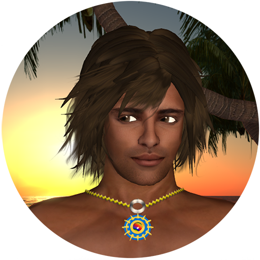
States, islands & seas of the Irukandji Continent
This section of the site is an historical record of the 262 regions that formed the Irukandji Continent, or as it was known in-game, the Kingdom of Irukandji.
Don’t worry, there aren’t 262 pages – There used to be on the old site but this time instead of listing them region by region, I’m going state by state. Yes, Irukandji was that huge that it needed states. So instead of 262 pages, I’ve condensed the whole lot into just 13 pages. Thank me later. 😄
All the regions (a.k.a. simulators) from the various iterations of Irukandji – in Second Life, InWorldz, Reef VR, SpotOn3D, and DigiWorldz – are listed here. Each region was my original design and canvas, hand terraformed and planted – no copy and past .oar files like the noobs use today.
On top of this, a massive and diverse community of people joined me on my regions, adding their own homes, shops, and artistic content as part of their avatars’ daily lives.
The look, the society, the culture, the ambience, the art – Irukandji was visually stunning, breath taking, and unbelievably huge. Even today, fifteen years on, it remains the largest virtual continent ever created in the southern hemisphere.
So, here it is, 15+ years of my creative time, and 20,000+hours in the making, a snapshot of Irukandji in all its forms.
Andrew Thompson a.k.a. Xay Tomsen

Andrew has created, nurtured, and destroyed many glittering kingdoms, but nowadays just tinkers with code, occasionally yelling like a madman at his scruffy NPC minions.
Note: if you are trying to visit the current Irukandji world, the landing sim is Arius on the DigiWorldz grid. The region is hypergrid enabled for easy teleportation from other Open Simulator virtual worlds. If you have the Firestorm viewer, use this link to teleport to Arius.
States & regions
Aboyo

Aboyo State is comprised of:
- Aboyo Island
- Aboyo Sea
- Cabria Island
- Eromanga Reef
- Eromanga Sea
- Grand Aboyo Island
- Kanua Island
- Manatu Island
- Mount Aboyo Island
- Octane Island
- Old Fort Island
- South Irukandji Sea
- Tasman Sea
- Tora Tora Passage
- Toraboyo Beach
- Valhalla Island
Arius

Located on the DigiWorldz grid, Arius is a standalone region.
Heahu

Heahu State consists of:
- Arms of Patroklos
- Baie de Citron
- Boyfriend Beach
- Byron Bay
- Crystal Atolls
- Hephaestion
- Kalua Bay
- Mount Krustallos
- Palace Lagoon
- Split Rock Mountain
- Valkyrie Island
- Valkyrie Shoals
Jillaroo
Jillaroo State consists of several regions:
- Barramundi Bay
- Captain Cook Reef
- Coolangatta
- Coraki Lagoons
- Great Keppel Island
- Jackaroo Island
- Mantaray Shoals
- Tanawayo Bay
- Tuvalu Straits
- Whitsunday Island
- Yeppoon Atolls
Kalamat

Kalamat State comprises:
- Aquitaine Bay
- Aratura City
- Baie de Triomphe
- Grand Kalamat Island
- Haku
- Kalamantayo
- Kalamat Island
- New Batavia
- North Shore
- Plage de Kalamat
- Rainbow Reef
- Sunset Shoals
Palu

The Palu State consists of:
Pinjarra

Pinjarra State comprises:
- Bay of Plenty
- Irukandji Sound
- Irukandji Village
- Kebo Atoa
- Pinjarra Island
- Pinjarra Shoals
- Sulawesi Bay
Reef VR

Reef VR regions were:
Tamita

The regions of Tamita State are:
- Adonis Beach
- Adonis Lagoon
- Alantay Island
- Avion Beach
- Baie de l’Amore
- Blue Lagoon
- Iruka Bay
- Irukandji Straits
- Lagune d’Or
- Minoan Atolls
- Nouvelle Kiribas
- Papeete Island
- Tamita Bay
- Tamita Island
- Tiamo Reef
- Xanadu Island
Weta

Weta State comprises:
- Convict Island
- Emperor Bay
- Grand Irukandji
- Horn of Weta
- Reef City
- Tongabuti Bay
- Upper Aboyo Passage
- Weta Island
- Weta Rim
Satellite regions

While these satellite regions were Irukandji themed, they were completely separate, existing only between iterations of the estate.


Leave a Reply